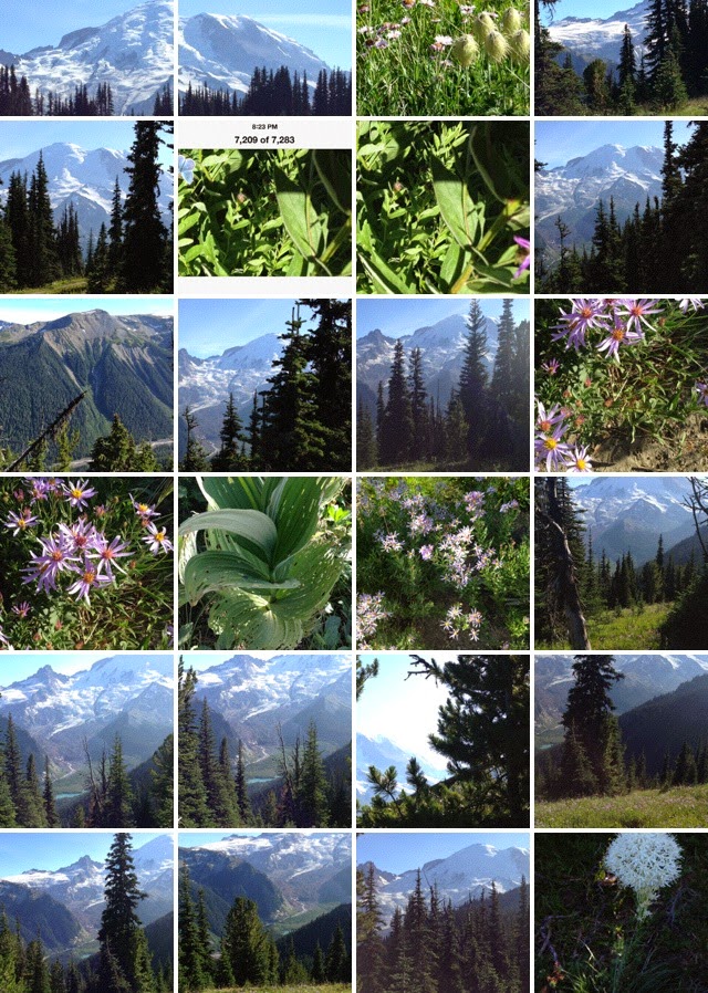
Spent a lot of time at Mt Rainier this summer, here are some pics of trails we hiked.
Frozen Lake Loop Trail (3 mi/4.8 km)
Follow the Sunrise Nature Trail to the ridgetop, then head west on the Sourdough Ridge Trail. Return to Sunrise via the Wonderland Trail and Old Campground Trail.
iphone pics, darn, I don't think it shows the glacial blue green
I can't wait for the new iphone, maybe I'll get a gift! 8 megapixels!!
I wasn't able to get all the trail, my phone battery died. It was a nice hike.
Mount Fremont Lookout Trail (5.6 mi/9.0 km)
Follow Sourdough Ridge Trail to the Mount Fremont Trail. This trail leads to a historic fire lookout with excellent views of Mount Rainier and its glaciers along the way.

At an elevation of 6,400 feet, Sunrise is the highest point that can be reached by vehicle at Mount Rainier National Park. In summer, mountain meadows abound with wildflowers. On clear days, Sunrise provides breathtaking views of Mount Rainier, Emmons glacier, and many other volcanoes in the Cascade Range. These views and an excellent trail system make Sunrise the second most visited location in the park.
Sunrise is located 60 miles northeast of the Nisqually Entrance and 14 miles northwest of the Sunrise/White River turnoff on Highway 410.
The Sunrise Road usually opens in late June or early July and closes in late September to early October. Check the before setting out.