
28.9.11
More Bonsai.


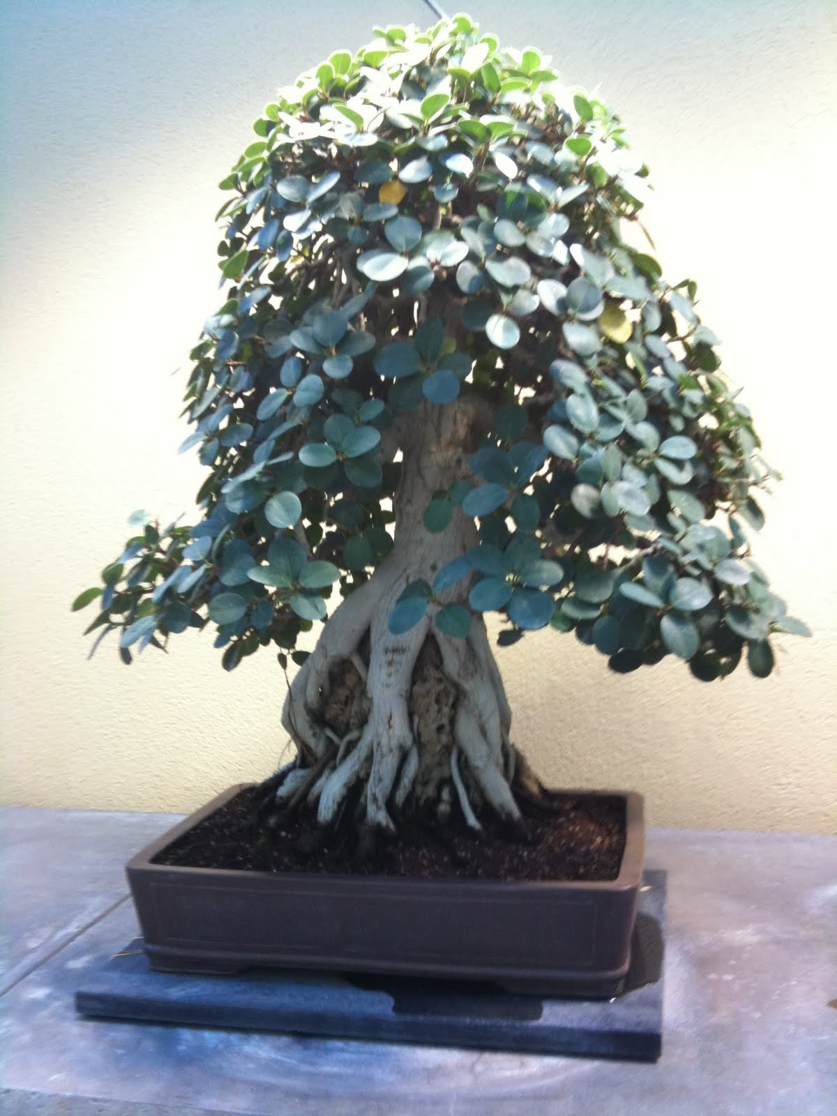
Bonsai Collection, Weyerhauser.


Below, new growth is grafted on old windswept dead wood to create that beauty.


26.9.11
Just to post a post

Been flat lately, and not doing much.
So I have taken a few crooked and reflective pictures to upload.
Terrarium
beer with slated rim
drum
oil lamp
Blue

suzani stool
kilims, rugs
gabbeh pillows
Bookcases, art
weights

Self portrait in exotic shell collection

17.9.11
Coupeville WA on The Island


Nearby...
Ebey's Landing National Historical Reserve Ebey’s Landing is the nation’s first historical reserve, created in 1978 to protect a rural working landscape & community on Central Whidbey Island. The reserve includes 17,500 acres, 17 farms, over 400 historical structures, native prairies, two state parks, miles of shoreline, a network of trails and the second oldest town in Washington. The Reserve is managed by a 9-member Trust Board. |


Coupeville, Wa
Coupeville was founded in 1852 by Captain Thomas Coupe and is the second oldest town in the State of Washington. The town continues to preserve original pioneer homes with a variety of historic architectures including Queen Anne, Saltbox, and pioneer Block Houses. Coupe's original home, built in 1853, is one of the State's oldest. Coupeville's limits overlay Ebey's Landing National Historical Reserve established by Congress in 1980 as the first and one of the largest such reserves in the nation. Its 22 square miles (57 km2) encompass farmlands, Fort Ebey State Park, beaches, parks, trails and 91 nationally registered historic structures. Coupeville was officially incorporated on April 20, 1910.

11.9.11
The beautiful Ohanapecosh river at Mt Rainier Nat'l Park


Located in the southeast corner of the park, Ohanapecosh, named for a Taidnapam (Upper Cowlitz) Indian habitation site along the river, is thought to mean “standing at the edge.” Situated among Douglas firs, western red cedars, and western hemlocks, visitors to Ohanapecosh can experience the beauty and complexity of an old-growth forest. The east side of the park is also somewhat drier and sunnier than the west side, making it a good destination when Paradise and Longmire are wet and foggy. Ohanapecosh is not accessible in winter.
http://www.nps.gov/mora/planyourvisit/ohanapecosh.htm
Currents of Ohanapecosh
I could sit and watch these currents for hours....
it was great fun climbing around on the log jam, and also seeing a family doing likewise. Obviously not used to balancing on logs, but the cool thing was, they were trying..


The Ohanapecosh Campground and picnic area is located on the banks of the peaceful Ohanapecosh River, within a majestic old-growth forest. Like the visitor center, the campground is open from late May to early October.The Ohanapecosh Campground and picnic area is located on the banks of the peaceful Ohanapecosh River, within a majestic old-growth forest. Like the visitor center, the campground is open from late May to early October.
9.9.11


7.9.11

Frozen Lake, Mt Rainier

Spent a lot of time at Mt Rainier this summer, here are some pics of trails we hiked.
Frozen Lake Loop Trail (3 mi/4.8 km)
Follow the Sunrise Nature Trail to the ridgetop, then head west on the Sourdough Ridge Trail. Return to Sunrise via the Wonderland Trail and Old Campground Trail.

iphone pics, darn, I don't think it shows the glacial blue green
I can't wait for the new iphone, maybe I'll get a gift! 8 megapixels!!
I can't wait for the new iphone, maybe I'll get a gift! 8 megapixels!!

I wasn't able to get all the trail, my phone battery died. It was a nice hike.

Mount Fremont Lookout Trail (5.6 mi/9.0 km)
Follow Sourdough Ridge Trail to the Mount Fremont Trail. This trail leads to a historic fire lookout with excellent views of Mount Rainier and its glaciers along the way.
Follow Sourdough Ridge Trail to the Mount Fremont Trail. This trail leads to a historic fire lookout with excellent views of Mount Rainier and its glaciers along the way.

At an elevation of 6,400 feet, Sunrise is the highest point that can be reached by vehicle at Mount Rainier National Park. In summer, mountain meadows abound with wildflowers. On clear days, Sunrise provides breathtaking views of Mount Rainier, Emmons glacier, and many other volcanoes in the Cascade Range. These views and an excellent trail system make Sunrise the second most visited location in the park.
Sunrise is located 60 miles northeast of the Nisqually Entrance and 14 miles northwest of the Sunrise/White River turnoff on Highway 410.
The Sunrise Road usually opens in late June or early July and closes in late September to early October. Check the road status before setting out.
Subscribe to:
Posts (Atom)